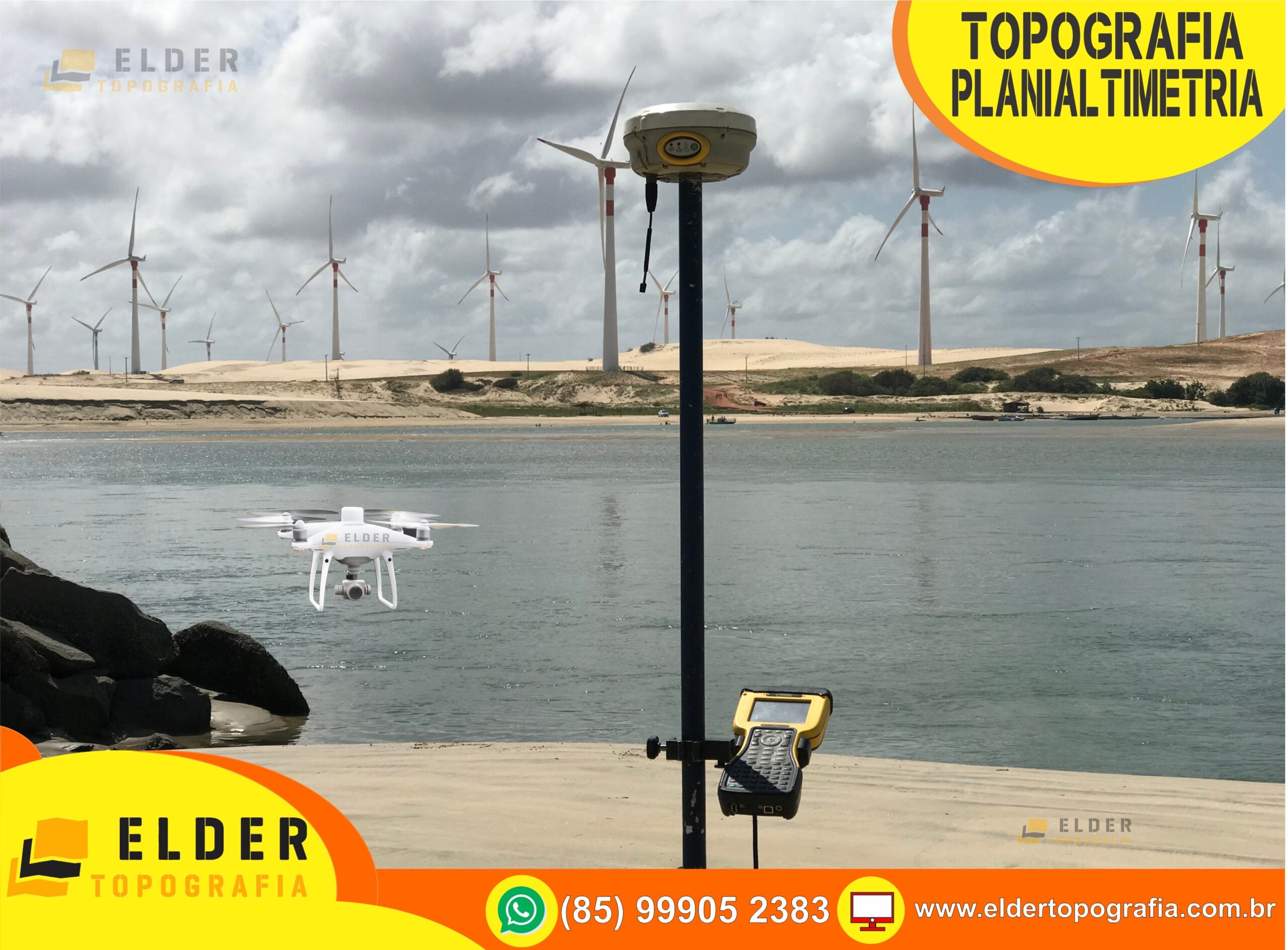
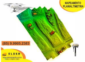
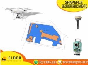
O georreferenciamento consiste na determinação dos limites do imóvel (neste estudo o imóvel rural) através de coordenadas georreferenciadas ao Sistema Geodésico Brasileiro. Estas coordenadas devem ter precisão posicional fixada pelo INCRA- Instituto Nacional de Colonização e Reforma Agrária. Nos termos do artigo 176, §3º, da Lei nº. 6.015/73, a identificação do imóvel rural objeto de desmembramento, parcelamento, remembramento ou de qualquer hipótese de transferência deverá ser obtida a partir de memorial descritivo, firmado por profissional habilitado e com a devida Anotação de Responsabilidade Técnica – ART, com as coordenadas dos vértices definidores dos limites do imóvel, georreferenciadas ao Sistema Geodésico Brasileiro e com precisão posicional a ser fixada pelo INCRA, que certificará que o imóvel não se sobrepõe a qualquer outro imóvel do seu cadastro georreferenciado.
Quais são os prazos legais?
O artigo 10 do Decreto nº 4.449/2002, com as alterações efetivadas pelo Decreto nº 5.570/2005, estipulou prazos para que os imóveis rurais sejam incluídos no SGB atual.
A contagem do prazo se iniciou a partir do dia 20/11/2003 (§3º do artigo 10) e levam em Consideração a dimensão do imóvel rural, sendo:
20/11/2013: áreas entre 250 hectares à 500 hectares;
20/11/2016: áreas entre 100 hectares à 250 hectares;
20/11/2019: áreas entre 25 hectares e 100 hectares; e
20/11/2023: áreas abaixo de 25 hectares.
Engenheiros Agrimensores, Engenheiros Cartógrafos, Tecnólogos e Técnicos nestas modalidades, que tenham em sua grade curricular disciplinas e conteúdos formativos estabelecidos pela PL 2087/2004 e ter atribuições de acordo com a PL-1221/2010 do CONFEA.
Contato: (85) 9.9905.2383 ( Wathsapp)
https://topografoemfortaleza.negocio.site/
www.creadigital.com.br/ce/eldertopografia
- GEORREFERENCIAMENTO DE IMÓVEL RURAL INCRA
- GEORREFERENCIAMENTO DE PARQUE EÓLICO (85) 9.9905.2383
- GEORREFERENCIAMENTO DE PARQUE SOLAR (85) 9.9905.2383
- GEORREFERENCIAMENTO DE USINA EÓLICO (85) 9.9905.2383
- GEORREFERENCIAMENTO DE USINA SOLAR (85) 9.9905.2383
- GEORREFERENCIAMENTO LINHA DE TRANSMISSÃO
- TOPOGRAFIA PARA INSTALAÇÃO DE PARQUE EÓLICO
- TOPOGRAFIA PARA INSTALAÇÃO DE PARQUE SOLAR
- GERAÇÃO DE CURVAS DE NÍVEL (85) 9.9905.2383
- CALCULOS DE ÁREA E VOLUME (85) 9.9905.2383
- LEVANTAMENTO PLANIALTIMÉTRICO TOPOGRÁFICO EM FORTALEZA
- MAPEAMENTO DE ÁREAS ATINGIDAS POR QUEIMADAS
- MONITORAMENTO DE ÁREA DE MINERAÇÃO
- CERTIFCAÇÃO DE IMÓVEL JUNTO AO INCRA (85) 9.9905.2383
- CERTIFCAÇÃO GEO INCRA (85) 9.9905.2383
- GEORREFERNCIAMENTO RURAL INCRA (85) 9.9905.2383
- CERTIFCAÇÃO DE IMÓVEL RURAL INCRA (85) 9.9905.2383
- PROFISSIONAL CREDENCIADO INCRA (85) 9.9905.2383
- TOPOGRAFIA EM GERAL (85) 9.9905.2383
- GEORREFERENCIAMENTO RURAL E URBANO (85) 9.9905.2383
- CADASTRO AMBIENTAL RURAL CAR (85) 9.9905.2383
- LEVANTAMENTO PLANIALTIMÉTRICO (85) 9.9905.2383
- CURVAS DE NIVEL APLHAVILLE CEARÁ (85) 9.9905.2383
- PLANIALTIMETRIA ALPHAVILLE CEARÁ (85) 9.9905.2383
- PLANTA GEORREFERENCIADA ALPHAVILLE CEARÁ (85) 9.9905.2383
- AÇÃO DE USUCAPIÃO E SHAPEFILE / SHAPE (ARQUIVO KML OU KMZ DO GOOGLE EARTH).
- PROFISSIONAL CREDENCIADO INCRA FORTALEZA (85) 9.9905.2383
- TOPOGRAFIA EM FORTALEZA (85) 9.9905.2383
- EMPRESA DE TOPOGRAFIA E GEORREFERENCIAMENTO EM FORTALEZA / CEARÁ
- EMPRESA DE TOPOGRAFIA EM FORTALEZA / CEARÁ
- EMPRESA DE TOPOGRAFIA (85) 9.9905.2383
- TOPOGRAFIA E GEORREFERENCIAMENTO EM FORTALEZA / CEARÁ
- TOPOGRAFIA E GEORREFERENCIAMENTO (85) 9.9905.2383
- TOPOGRAFO TOPOGRAFIA (85) 9.9905.2383
- EMPRESA DE GEORREFERENCIAMENTO EM FORTALEZA / CEARÁ
- EMPRESA DE TOPOGRAFIA E GEORREFERENCIAMENTO EM FORTALEZA
- GEORREFERENCIAMENTO GEO INCRA(85) 9.9905.2383
- EMPRESA DE GEORREFERENCIAMENTO ESPECIALISTA EÓLICA E SOLAR
- GEORREFERENCIAMENTO EM FORTALEZA (85) 9.9905.2383
- GEORREFERENCIAMENTO (85) 9.9905.2383
- EMPRESA DE USUCAPIÃO EM FORTALEZA / CEARÁ (85) 9.9905.2383
- EMPRESA DE USUCAPIÃO (85) 9.9905.2383
- EMPRESA DE TOPOGRAFIA E GEORREFERENCIAMENTO EM FORTALEZA
- PROFISSIONAL CREDENCIADO INCRA FORTALEZA (85) 9.9905.2383
- USUCAPIÃO EM FORTALEZA (85) 9.9905.2383
- GEO INCRA EM FORTALEZA (85) 9.9905.2383
- USUCAPIÃO (85) 9.9905.2383
- EMPRESA DE SHAPEFILE EM FORTALEZA / CEARÁ (85) 9.9905.2383
- EMPRESA DE SHAPEFILE (85) 9.9905.2383
- SHAPEFILE EM FORTALEZA (85) 9.9905.2383
- SHAPEFELE (85) 9.9905.2383
- EMPRESA EM FORTALEZA – CEARÁ (85) 9.9905.2383
- TOPOGRAFO EM FORTALEZA -CEARÁ (85) 9.9905.2383
- TOPOGRAFO EM FORTALEZA (85) 9.9905.2383
- TOPOGRAFO E TOPOGRAFIA (85) 9.9905.2383
- EMPRESA CERTIFICAÇÃO INCRA / SIGEF E CAR (85) 9.9905.2383
- EMPRESA DE GEORREFERENCIAMENTO RURAL (85) 9.9905.2383
- GEORREFERENCIAMENTO RURAL (85) 9.9905.2383
- SERVIÇO PARA SHAPEFILE SEMACE: (85) 9.9905.2383
- SERVIÇO DE GEORREFERENCIAMENTO: (85) 9.9905.2383
- SERVIÇO DE TOPOGRAFIA EM GERAL: (85) 9.9905.2383
- GEORREFERENCIAMENTO USINA FOTOVOLTAICA E EÓLICA (85) 9.9905.2383
- EMPRESA DE GEORREFERENCIAMENTO EM FORTALEZA (85) 9.9905.2383
- SERVIÇO DE CERTIFICAÇÃO INCRA SIGEF EM FORTALEZA
- SERVIÇO PARA USUCAPIÃO: (85) 9.9905.2383
- GEORREFERENCIAMENTO EM FORTALEZA (85) 9.9905.2383
- EMPRESA DE GEORREFERENCIAMENTO (85) 9.9905.2383
- TOPOGRAFIA EM FORTALEZA (85) 9.9905.2383
- PLANTA GEORREFERENCIADA E MEMORIAL DESCRITIVO (85) 9.99052383
- TOPOGRAFIA COM GEORRENCIAMENTO (85) 9.9905.2383
- SERVIÇO DE GEO INCRA EM FORTALEZA CEARÁ (85) 9.9905.2383
- SHAPEFILE EM FORTALEZA (85) 9.9905.2383
- SHAPEFILE E GEORREFERENCIAMENTO (85) 9.9905.2383
- EMPRESA DE TOPOGRAFIA EM FORTALEZA (85) 9.9905.2383
- EMPRESA DE TOPOGRAFIA (85) 9.9905.2383
- TOPOGRAFO E GPS RTK (85) 9.9905.2383
- TOPOGRAFO EM FORTALEZA (85) 9.9905.2383
- LAUDO DE DESCARACTERIZAÇÃO DE IMÓVEL INCRA (CCIR)
- EMPRESA DE USUCAPIÃO EM FORTALEZA (85) 9.9905.2383
- EMPRESA DE USUCAPIÃO (85) 9.9905.2383
- USUCAPIÃO EM FORTALEZA (85) 9.9905.2383
- USUCAPIÃO (85) 9.9905.2383
- EMPRESA DE SHAPEFILE EM FORTALEZA (85) 9.9905.2383
- EMPRESA DE SHAPEFILE (85) 9.9905.2383
- PLANTA GEORREFERENCIADA EM FORTALEZA (85) 9.99052383
- LEVANTAMENTO TOPOGRÁFICO GEORREFERENCIADO EM FORTALEZA
- TOPOGRAFO CREDENCIADO INCRA (85) 9.9905.2383
TAGS: CERTIFICAÇÃO DE IMÓVEIS RURAIS, CERTIFICAÇÃO INCRA FORTALEZA, CERTIFICAÇÃO JUNTO AO INCRA, DESMEMBRAMENTO, EMPRESA CERTIFICAÇÃO INCRA SIGEF E CAR, EMPRESA DE GEORREFERENCIAMENTO, EMPRESA DE GEORREFERENCIAMENTO EM FORTALEZA, EMPRESA DE GEORREFERENCIAMENTO EM FORTALEZA CEARÁ, EMPRESA DE GEORREFERENCIAMENTO EM FORTALEZA-CE, EMPRESA DE GEORREFERENCIAMENTO RURAL, EMPRESA DE SHAPE EM FORTALEZA CEARÁ, EMPRESA DE SHAPEFILE, EMPRESA DE SHAPEFILE EM FORTALEZA, EMPRESA DE SHAPEFILE EM FORTALEZA CEARÁ, EMPRESA DE SHAPEFILE EM FORTALEZA-CE, EMPRESA DE SHAPEFILE SEMACE EM FORTALEZA CEARÁ, EMPRESA DE TOPOGRAFIA, EMPRESA DE TOPOGRAFIA E GEORREFERENCIAMENTO EM FORTALEZA, EMPRESA DE TOPOGRAFIA E GEORREFERENCIAMENTO EM FORTALEZA / CEARÁ, EMPRESA DE TOPOGRAFIA EM FORTALEZA, EMPRESA DE TOPOGRAFIA EM FORTALEZA CEARÁ., EMPRESA DE TOPOGRAFIA EM FORTALEZA-CE, EMPRESA DE USUCAPIÃO, EMPRESA DE USUCAPIÃO EM FORTALEZA, EMPRESA DE USUCAPIÃO EM FORTALEZA CEARÁ, EMPRESA EM FORTALEZA – CEARÁ, GEO INCRA EM FORTALEZA, GEORREFERENCIAMENTO, GEORREFERENCIAMENTO EM FORTALEZA, GEORREFERENCIAMENTO EM FORTALEZA CEARÁ-CE, GEORREFERENCIAMENTO RURAL, GEORREFERENCIAMENTO RURAL E URBANO, GOOGLE EARTH, KML, KMZ, LAUDO DE DESCARACTERIZAÇÃO DE IMÓVEL INCRA, LEVANTAMENTO TOPOGRÁFICO EM FORTALEZA CEARÁ, LEVANTAMENTO TOPOGRÁFICO EM FORTALEZA-CE, LEVANTAMENTO TOPOGRÁFICO GEORREFERENCIADO EM FORTALEZA, PLANTA GEORREFERENCIADA E MEMORIAL DESCRITIVO, PLANTA GEORREFERENCIADA EM FORTALEZA, PLANTAS PARA INVENTÁRIO, PLANTAS PARA USUSCAPIÃO, PROFISSIONAL CREDENCIADO INCRA FORTALEZA, PROFISSIONAL HABILITADO NO INCRA., SERVIÇO DE CERTIFICAÇÃO INCRA SIGEF EM FORTALEZA, SERVIÇO DE GEO INCRA EM FORTALEZA CEARÁ, SERVIÇO DE GEORREFERENCIAMENTO, SERVIÇO DE TOPOGRAFIA EM GERAL, SERVIÇO PARA SHAPEFILE SEMACE, SERVIÇO PARA USUCAPIÃO, SHAPE SEMACE EM FORTALEZA CEARÁ, SHAPEFELE, SHAPEFILE E GEORREFERENCIAMENTO, SHAPEFILE EM FORTALEZA, SHAPEFILE EM FORTALEZA CEARÁ, SHAPEFILE SEMACE CEARÁ, SHAPEFILE SEMACE EM FORTALEZA CEARÁ, SIGEF, TOPOGRAFIA, TOPOGRAFIA COM GEORRENCIAMENTO, TOPOGRAFIA E GEORREFERENCIAMENTO, TOPOGRAFIA E GEORREFERENCIAMENTO EM FORTALEZA CEARÁ, TOPOGRAFIA EM FORTALEZA, TOPOGRAFIA EM FORTALEZA CEARÁ, TOPOGRAFIA EM FORTALEZA-CE, TOPOGRAFIA EM GERAL, TOPOGRAFIA PARA INVENTÁRIOS, TOPOGRAFO CREDENCIADO, TOPÓGRAFO CREDENCIADO NO CREA E INCRA., TOPOGRAFO E GPS RTK, TOPOGRAFO E TOPOGRAFIA, TOPOGRAFO EM FORTALEZA, TOPOGRAFO EM FORTALEZA CEARÁ
- Topografo em Russas, Beberibe, Quixeré, Jaguaruana, Palhano, Morada Nova e Limoeiro do Norte, Quixadá, Ocara.
- Topografo em Aracati, Fortim, Icapuí, Tibau, Arreia Branca, Mossoró, João Câmara, Lajes, Jandaíra, Pedra Preta.
- Topografo em Palhano, Itaiçaba, Jaguaruana, Quixeré, Limoeiro do Norte, Tabuleiro do Norte, Russas, Acarape.
- Topografo em São João do Jaguaribe, Morada Nova, Ibicuitinga, Quixadá, Ibaretama, Choró, Aracoiaba, Ocara, Itapiúna.
- Topografo em Solonópole, Jaguaribe, Jaguaribara, Jaguaretama, Banabuiú, Quixelô, Orós, Iracema, Alto Santo.
- Topografo em Quixeramobim, Milhã, Senador Pompeu, Pedra Branca, Boa Viagem, Madalena, Itatira, Choró, Quixadá.
- Topografo em Crateús, Ipaporanga, Poranga, Ipueiras, Nova Russas, Tamboril, Independência, Pedra Branca, Madalena.
- Topografo em Canindé, Santa Quitéria, Hidrolândia, Ipu, Croatá, Ipueiras, Varjota, Reriutaba, Guaraciaba do Norte.
- Topografo em São Benedito, Pires Ferreira, Carnaubal, Graça, Reriutaba, Pacujá , Mucambo, Ibiapina, Ubajara.
- Topografo em Granja, Viçosa do Ceará, Frecheirinha, Coreaú, Moraujó, Uruoca, Martinópole, Meruoca, Senador Sá, Massapê.
- Topografo em Sobral, Forquilha, Groaíras, Cariré, Santana do Acaraú, Morrinhos, Miraíma, Irauçuba, Marco, Cruz.
- Topografo em Chaval, Barroquinha, Camocim, Jijoca de Jericoacoara, Bela Cruz, Acaraú, Marco, Itarema, Amontada.
- Topógrafo em Itapagé, Tejuçuoca, Itapipoca, Umirim, Uruburetama, Tururu, Tejuçuoca, General Sampaio, Paramoti, Apuiarés.
- Topógrafo em Trairí, Paraipaba, Paracuru, São Gonçalo do Amarante, São Luis do Curú, Pentecoste, Caridade, Amontada.
- Topógrafo em Fortaleza, Caucaia, Maracanaú, Maranguape, Pacatuba, Guaiúba, Palmácia, Pacoti, Redenção, Baturité.
- Topógrafo em Guaramiranga, Pacoti, Mulungu, Aratuba, Itapiúna, Aracoiaba, Barreira, Redenção, Palmácia, Ocara.
- Topografo em Aquiraz, Eusébio, Pindoretama, Cascavél, Chorozinho, Pacajus, Horizonte, Acarape, Itaitinga, Eusébio.
- Topografo em Beberibe, Cascavél, Fortim, Aracati, Icapuí, Jaguaruana, Itaiçaba, Palhano, Russas, Quixeré, Morada Nova.
- Georreferenciamento e Topografia em Beberibe, Cascavél, Fortim, Aracati, Icapuí, Jaguaruana, Itaiçaba, Palhano, Russas.
- Georreferenciamento em Aquiraz, Eusébio, Pindoretama, Cascavél, Chorozinho, Pacajus, Horizonte, Acarape, Itaitinga.
- Georreferenciamento em Guaramiranga, Pacoti, Mulungu, Aratuba, Itapiúna, Aracoiaba, Barreira, Redenção, Palmácia, Ocara.
- Georreferenciamento Fortaleza, Caucaia, Maracanaú, Maranguape, Pacatuba, Guaiúba, Palmácia, Pacoti, Redenção, Baturité.
- Georreferenciamento em Trairí, Paraipaba, Paracuru, São Gonçalo do Amarante, São Luis do Curú, Pentecoste, Caridade.
- Georreferenciamento em Itapagé, Tejuçuoca, Itapipoca, Umirim, Uruburetama, Tururu, Tejuçuoca, General Sampaio, Paramoti.
- Georreferenciamento em Chaval, Barroquinha, Camocim, Jijoca de Jericoacoara, Bela Cruz, Acaraú, Marco, Itarema, Amontada.
- Georreferenciamento em Sobral, Forquilha, Groaíras, Cariré, Santana do Acaraú, Morrinhos, Miraíma, Irauçuba, Marco, Cruz.
- Georreferenciamento em Granja, Viçosa do Ceará, Frecheirinha, Coreaú, Moraujó, Uruoca, Martinópole, Meruoca, Senador Sá.
- Georreferenciamento em São Benedito, Pires Ferreira, Carnaubal, Graça, Reriutaba, Pacujá , Mucambo, Ibiapina, Ubajara.
- Georreferenciamento Canindé, Santa Quitéria, Hidrolândia, Ipu, Croatá, Ipueiras, Varjota, Reriutaba, Guaraciaba Norte.
- Georreferenciamento Crateús, Ipaporanga, Poranga, Ipueiras, Nova Russas, Tamboril, Independência, Pedra Branca Madalena.
- Georreferenciamento em Quixeramobim, Milhã, Senador Pompeu, Pedra Branca, Boa Viagem, Madalena, Itatira, Choró, Quixadá.
- Georreferenciamento em Solonópole, Jaguaribe, Jaguaribara, Jaguaretama, Banabuiú, Quixelô, Orós, Iracema, Alto Santo.
- Georreferenciamento São João Jaguaribe, Morada Nova, Ibicuitinga, Quixadá, Ibaretama, Choró, Aracoiaba, Ocara, Itapiúna.
- Georreferenciamento em Palhano, Itaiçaba, Jaguaruana, Quixeré, Limoeiro do Norte, Tabuleiro do Norte.
- Georreferenciamento em Aracati, Fortim, Icapuí, Tibau, Arreia Branca, Mossoró, João Câmara, Lajes, Jandaíra, Pedra Preta.
- Georreferenciamento em Russas, Beberibe, Quixeré, Jaguaruana, Palhano, Morada Nova e Limoeiro do Norte, Quixadá, Ocara.


https://eldertopografia.com.br/2021/01/21/servicos-da-empresa-elder-topografia-georreferenciamento-usucapiao-e-shapefile-em-fortaleza-2/
https://eldertopografia.com.br/2021/01/06/empresa-e-servicos-de-topografia-georreferenciamento-e-shape-semace-seuma-topografo-em-fortaleza-ceara-85-9-9905-2383/
https://eldertopografia.com.br/2021/01/06/empresa-de-topografia-em-fortaleza-georreferenciamento-shapefile-usucapiao-topografo-em-fortaleza-ceara-85-9-9905-2383/
https://eldertopografia.com.br/2020/12/13/topografo-em-fortaleza-ceara-credenciado-no-incra-e-crea-com-levantamentos-topograficos-e-servicos-de-topografia-georreferenciamento-usucapiao-e-shapefile-85-9-99052383/
https://eldertopografia.com.br/2020/10/22/laudo-de-descaracterizacao-de-imovel-rural-incra-fortaleza-ceara-85-9-9905-2383/
https://eldertopografia.com.br/2020/10/01/planta-georreferenciada-para-usucapiao-85-9-9905-2383/
https://eldertopografia.com.br/2020/09/30/empresa-de-shapefile-semace-fortaleza-ceara-85-9-9902383/
https://eldertopografia.com.br/2020/09/28/empresa-de-georreferenciamento-topografia-shapefile-semace-e-usucapiao-em-fortaleza-ceara-85-9-9905-2383/
https://eldertopografia.com.br/2020/09/28/servicos-da-empresa-elder-topografia-georreferenciamento-usucapiao-e-shapefile-em-fortaleza/
https://eldertopografia.com.br/2020/09/17/empresa-de-georreferenciamento-em-fortaleza-85-9-9905-2383/
https://eldertopografia.com.br/2020/09/17/empresa-de-topografia-em-fortaleza-85-9-9905-2383-2/
https://eldertopografia.com.br/2020/09/07/topografo-empresa-de-topografia-georreferenciamento-859-9905-2383/
https://eldertopografia.com.br/2020/09/04/empresa-e-servicos-de-shapefile-e-shape-85-9-99052383/
https://eldertopografia.com.br/2020/09/02/empresa-e-servico-de-topografia-shapefile-semace-e-seuma-georreferenciamento-e-usucapiao-em-fortaleza-ceara-85-9-99052383/
https://eldertopografia.com.br/2020/09/02/empresa-e-servicos-de-shapefile-em-fortaleza-ceara-85-9-9905-2383/
https://eldertopografia.com.br/2020/09/01/levantamento-topografico-lote-cidade-alpha-ceara-planialtimetrico-curvas-de-nivel-85-9-9905-2383/
https://eldertopografia.com.br/2020/08/28/servicos-da-empresa-elder-topografia-georreferenciamento-usucapiao-e-shapefile-em-fortaleza-ceara-85-9-9905-2383/
https://eldertopografia.com.br/2020/08/26/empresa-de-shapefile-shape-semace-e-seuma-fortaleza-ceara-85-9-9905-2383/
https://eldertopografia.com.br/2020/08/26/mapeamento-inspecao-e-fotografia-aerea-com-drone-em-todo-estado-do-ceara-85-9-9905-2383/
https://eldertopografia.com.br/2020/08/22/empresa-de-topografia-e-georreferenciamento-em-geral-85-9-9905-2383/
https://eldertopografia.com.br/2020/08/06/topografia-georreferenciamento-shapefile-semace-e-usucapiao-85-9-9905-2383-topografo-credenciado-crea-e-incra/
https://eldertopografia.com.br/2020/07/24/empresa-de-topografia-e-georreferenciamento-85-9-9905-2383/
https://eldertopografia.com.br/2020/07/24/usucapiao-shapefile-semace-topografo-certificacao-incra-sigef-85-9-9905-2383/
https://eldertopografia.com.br/2020/07/21/topografia-e-georreferenciamento-85-9-9905-2383-2/
https://eldertopografia.com.br/2020/06/26/levantamento-topografico-planialtimetrico-ceara-e-rio-grande-do-norte-85-9-9905-2383/
https://eldertopografia.com.br/2020/06/20/topografia-e-georreferenciamento-85-9-9905-2383/
https://eldertopografia.com.br/2020/06/15/mapeamento-e-inspecao-com-drone-ceara-e-rio-grande-do-norte-85-9-9905-2383/
https://eldertopografia.com.br/2020/06/10/empresa-de-topografia-topografo-ceara-e-rio-grande-do-norte-85-9-9905-2383/
https://eldertopografia.com.br/2020/06/07/servico-de-topografo-e-topografia-em-fortaleza-ceara-e-rio-grande-do-norte-85-9-9905-2383/
https://eldertopografia.com.br/2020/06/05/energia-eolica-ceara-e-rio-grande-do-norte-85-9-9905-2383/
https://eldertopografia.com.br/2020/06/03/georreferenciamento-de-parque-eolico-ceara-e-rio-grande-do-norte-85-9-9905-2383/
https://eldertopografia.com.br/2020/05/26/certificacao-de-imovel-rural-incra-ceara-859-9905-2383/
https://eldertopografia.com.br/2020/05/25/topografia-em-geral-85-9-99052383/
https://eldertopografia.com.br/2020/05/25/o-que-e-o-shapefile-semace-85-9-9905-2383/
https://eldertopografia.com.br/2020/05/24/o-que-faz-um-topografo-85-9-9905-2383/
https://eldertopografia.com.br/2020/05/23/o-que-e-a-certificacao-de-imovel-rural-no-incra-sigef-85-9-9905-2383/
https://eldertopografia.com.br/2020/05/22/por-que-e-obrigatorio-fazer-o-car-cadastro-ambiental-rural-85-9-9905-2383/
https://eldertopografia.com.br/2020/05/21/o-que-e-descaracterizacao-de-imovel-rural-incra/
https://eldertopografia.com.br/2020/05/21/a-importancia-do-georreferenciamento-de-imoveis-e-usucapiao-em-fortaleza-ceara/
https://eldertopografia.com.br/2020/04/29/a-importancia-do-levantamento-topografico-para-usucapiao-em-fortaleza-ceara-85-9-9905-2383/
https://eldertopografia.com.br/2020/04/29/topografo-85-9-9905-2383/
https://eldertopografia.com.br/2020/04/16/executamos-servicos-de-topografia-georreferenciamento-shapefile-e-usucapiao-em-fortaleza-ceara-85-9-9905-2383/
https://eldertopografia.com.br/2020/04/16/executamos-servicos-de-topografia-e-georreferenciamento-em-fortaleza-ceara-85-9-9905-2383/
https://eldertopografia.com.br/2020/04/16/servicos-de-empresa-de-topografia-85-9-9905-2383/
https://eldertopografia.com.br/2020/04/16/topografo-em-fortaleza-ceara-85-9-9905-2383/
https://eldertopografia.com.br/2020/04/16/servicos-da-empresa-elder-topografia-georreferenciamento-shapefile-e-usucapiao-em-fortaleza-ceara-85-9-99052383/
https://eldertopografia.com.br/2019/12/06/levantamento-topografico-planialtimetrico-georreferenciado-em-fortaleza-ceara-85-9-9905-2383/
https://eldertopografia.com.br/2019/12/06/levantamento-topografico-georreferenciado-no-ceara-sobral-caninde-quixada-quixeramobim-russas-beberibe-aracati-fortim/
https://eldertopografia.com.br/2019/11/18/servicos-da-empresa-elder-topografia-georreferenciamento-usucapiao-e-shapefile-em-fortaleza-ceara-2/
https://eldertopografia.com.br/2019/10/30/empresa-de-topografia-e-georreferenciamento-em-fortaleza-85-9-9905-2383/
https://eldertopografia.com.br/2019/10/29/servicos-da-empresa-elder-topografia-georreferenciamento-usucapiao-e-shapefile-em-fortaleza-85-9-9905-2383-2/
https://eldertopografia.com.br/2019/10/29/topografia-em-fortaleza-georreferenciamento-em-fortaleza-85-9-9905-2383/
https://eldertopografia.com.br/2019/09/09/empresa-de-topografia-e-georreferenciamento-em-fortaleza-ceara-85-9-9905-2383/
https://eldertopografia.com.br/2019/08/21/servicos-da-empresa-elder-topografia-georreferenciamento-usucapiao-e-shapefile-em-fortaleza-85-9-9905-2383/
https://eldertopografia.com.br/2019/08/21/empresa-de-georreferenciamento-em-fortaleza-ceara-85-9-9905-2383/
https://eldertopografia.com.br/2019/08/19/geoprocessamento-empresa-de-geoprocessamento-em-fortaleza-ceara-servico-de-geoprocessamento-e-topografia-em-fortaleza-ceara-85-9-9905-2383/
https://eldertopografia.com.br/2019/08/19/servicos-da-empresa-elder-topografia-georreferenciamento-usucapiao-e-shapefile-em-fortaleza-ceara/
https://eldertopografia.com.br/2019/08/17/topografia-e-georreferenciamento-em-fortaleza-ceara/
https://eldertopografia.com.br/2019/08/13/georreferenciamento-em-fortaleza-ceara-georreferenciamento-em-fortaleza-ce/
https://eldertopografia.com.br/2019/08/13/topografia-em-fortaleza-ceara-topografo-em-fortaleza-ce/
https://eldertopografia.com.br/2019/06/17/o-que-e-o-car/
https://eldertopografia.com.br/2019/06/09/a-utilizacao-de-drones-na-topografia/
https://eldertopografia.com.br/2019/06/01/certificacao-de-imovel-rural-no-incra-sigef-fortaleza-ceara/
https://eldertopografia.com.br/2019/05/29/topografia/
https://eldertopografia.com.br/2019/05/24/o-que-e-o-usucapiao/
https://eldertopografia.com.br/2019/05/21/aprovado-projeto-que-simplifica-o-georreferenciamento-de-propriedades-rurais/
https://eldertopografia.com.br/2019/02/28/georreferenciamento-de-areas-rurais/
https://eldertopografia.com.br/2019/02/27/o-que-e-topografia/
https://eldertopografia.com.br/2019/02/26/batimetria-e-topografia/
https://eldertopografia.com.br/empresa/
https://eldertopografia.com.br/servicos/
https://eldertopografia.com.br/blog/
https://eldertopografia.com.br/contato/